簽到天數: 3476 天 [LV.Master]伴壇終老
|
基本資料
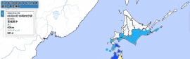
編號 :90 L
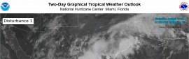
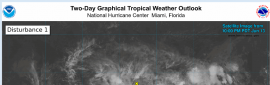
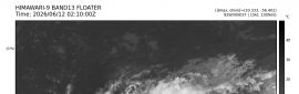
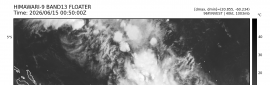
擾動編號日期:2026 年 06 月 16 日 02 時
撤編日期 :2026 年 06 月 00 日 00 時
90L.INVEST.15kts-1011mb-26.0N-101.0W

NHC : 40%
Northwestern Gulf of America:
A trough of low pressure located over northeastern Mexico is producing a large area of disorganized showers and thunderstorms. Development is not expected during the next day or so while the trough remains inland. However, the system could re-emerge over the northwestern Gulf of America late Tuesday or Wednesday, and environmental conditions there are marginally conducive for the formation of a short-lived tropical storm on Wednesday into Thursday. Regardless of tropical cyclone formation, interests across southern and eastern Texas and portions of Louisiana and Mississippi should prepare for periods of intense rainfall over the next several days which could produce widespread, life-threatening flash, urban, and river flooding. Gusty winds and coastal flooding are also possible along portions of the northwestern Gulf Coast, and Tropical Storm Watches or Warnings could be required on Tuesday. Additional information on this system can be found in products issued by your local National Weather Service Forecast Office or NHC Key Messages.
* Formation chance through 48 hours...medium...40 percent..
* Formation chance through 7 days...medium...50 percent..

|
|

 提升卡
提升卡 千斤頂
千斤頂 照妖鏡
照妖鏡